TATTENHAM CORNER & PRESTON
What’s in a Name?
We seem to be in a no man’s land between Epsom and Banstead, not known to the powers that be at the Royal Mail. Until the 1930’s we were part of Epsom Council, when we were given over to Banstead. In 1974 Banstead merged with Reigate, although a majority in our area declared through a poll that they wanted to go with Epsom.
As far as Royal Mail are concerned, parts of the ward are in Epsom Downs, now abbreviated to Epsom. Other parts are Burgh Heath, Tadworth, whilst the Preston area itself is just Tadworth.
Tattenham Corner
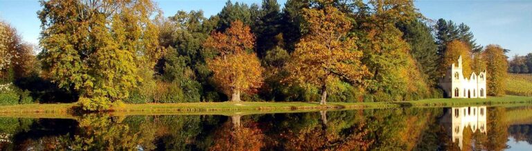
When you look at Tattenham Corner today, you might be forgiven for thinking that it has a long history. It certainly has many of the elements of an ancient settlement: houses, shops, railway station, clinic, community library, stables, public house, petrol station and nearby church and schools. But, go back 150 years and you would find only meadows (used for cattle pasture, sheep farming and wood gathering) and cart-tracks butting up against a racecourse.
The name Tattenhams first appears in a 1332 tax bill (what else!) for Roger de Totenham, of the ‘Township of Thadeworth, Preston & Bergh’, assessed at three shillings! Then in 1614, Christopher Buckle bought the manor of Great Burgh, along with 22 acres of land called Totnams. His estate stretched all the way from the Brighton Road to the edge of the racecourse.
It was not until the railway came to Tattenhams in 1901 that the area started to develop into what can be seen today.
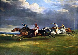
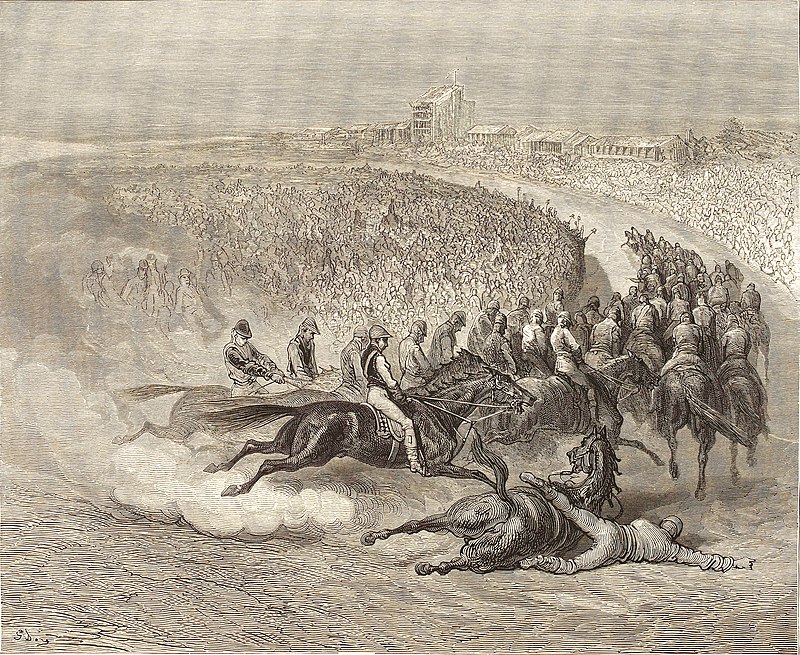
The Corner at Tattenhams, as any racing pundit will tell you, is a sharp bend in the racetrack and dates the 1770’s, with the first Derby race itself held in 1780. After a number of racing accidents, the racecourse’s sharp corner was replaced by a gentler curve in 1834.
Housing in any numbers didn’t really arrive until the 1930’s with a master plan for the Tattenham Corner Estate, but the majority of homes were built after the World War 2 through to the 1960’s, with infill sites continuing ever since. The first parade of shops at Tattenham Corner, nearest to the station, was built just before the war, with the areas opposite including the Co-op following in the 1950’s. The Tattenham Corner Pub was built in the 1930’s under a Home Office scheme (no, we’re not sure why either).
After the war, there was substantial council housing construction, initially in the Downland Way/ Upland Way area, and then with the Preston development.
Preston
Preston or Preston Hawe has a much older history, with the Manor of Preston being mentioned in the 1300’s. Lords of the Manor have included the Chetwode family, the Haytons, the Merlands and the Fleetwoods, all recognised in local road names. The Manor itself was a fantastic moated site now split by Preston Lane near to Marbles Way. St Leonard’s Chapel was associated with the Manor and stood in Chapel Grove, but was a ruin by the 1400’s.
Until after World War 2, the area was farmed and split between North Tadworth farm and South Tadworth farm. Both private and council housing rapidly spread, with the land being developed by Banstead Council together with London overspill built by the boroughs of Merton and Sutton. The first leisure centre and swimming pool was built and the de Burgh Secondary School opened in 1957. The school was merged with Nork Park School and moved to form The Beacon in 1989. The site is now being developed for housing by London Square.
Many of the properties were bought by their tenants in the 1980’s onwards under Mrs Thatcher’s “right to buy” scheme, and in 2000 Reigate & Banstead Council transferred its ownership to Raven, a housing trust.